

On our way home last night we tried to find the best spot to view the ongoing fire. We figured since we could see it so well from the Saratoga Springs side, that that must be the best place to view it. We drove around and pulled over a few times and thought we had a pretty good view.
Then we drove home and realized that we had a really good view from our front porch.
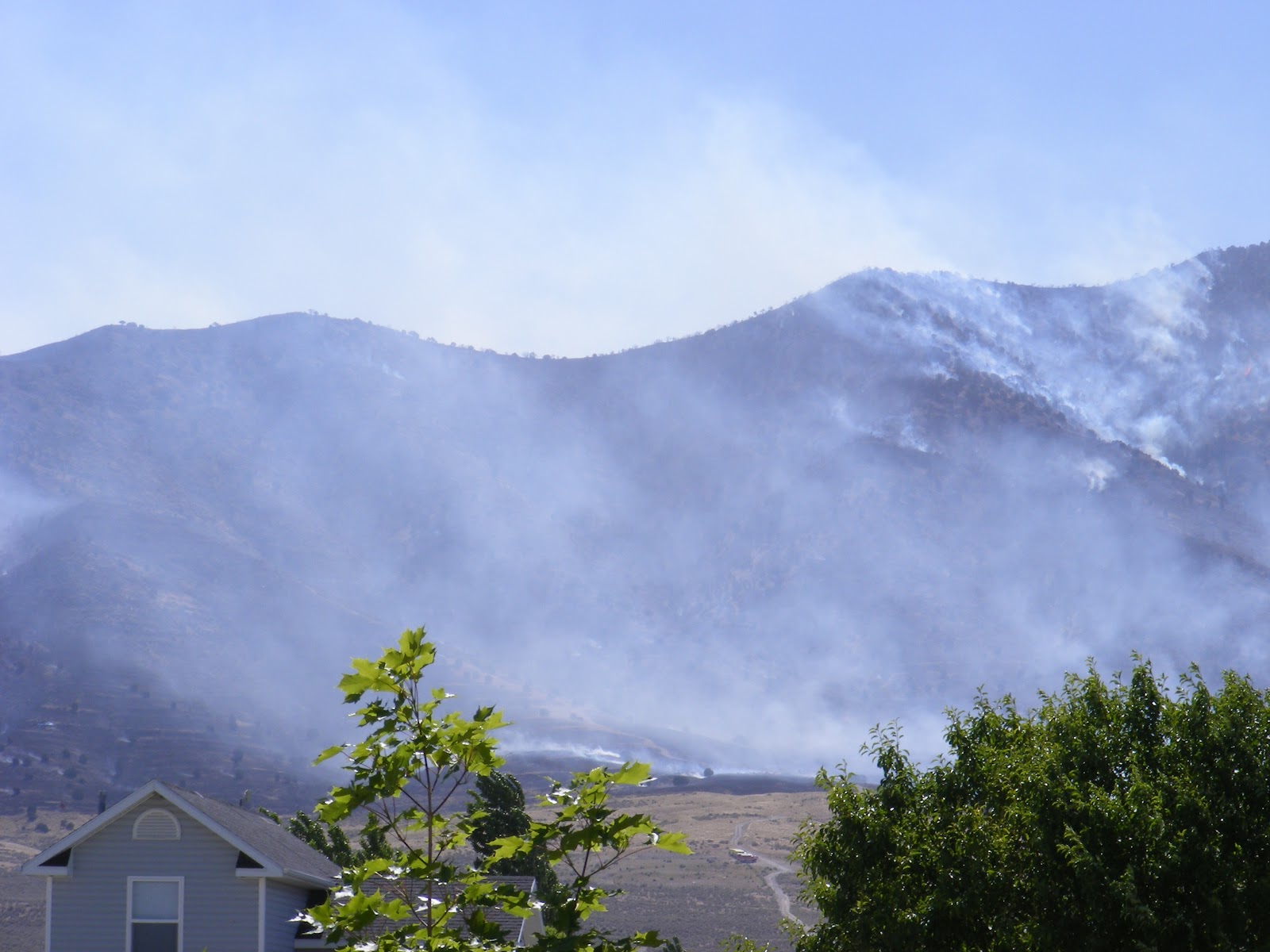
These were taken around 1:00 this morning:


Things have settled down on our side- taken 10:30 this morning.
We have not been evacuated but a good area around us has. Be safe out there! I hear there is ash anywhere from 15 to 50 miles away, probably more.
Just last weekend my husband noticed a fire further down the mountain and reported it and even tried to help contain it.
http://www.sltrib.com/sltrib/news/54356138-78/fire-saratoga-utah-fires.html.csp
http://www.sltrib.com/sltrib/news/54356138-78/fire-saratoga-utah-fires.html.csp
Windblown Dump Fire forces Saratoga Springs home evacuations
Hot, dry and windy » Triple-digit temperatures, parched vegetation brings ‘Red Flag’ warning.
By Bob Mims
| The Salt Lake Tribune
First Published 3 hours ago • Updated 1 minute agoGusty winds drove a northern Utah wildfire toward homes in the Saratoga Springs-Eagle Mountain area late Friday morning, forcing an evacuation order affecting about 250 families.
Interagency Fire Center spokeswoman Teresa Rigby said the winds whipped the Dump Wildfire’s flames through tinder-dry grasslands on the blaze’s eastern perimeter.
"We’re well above 750 acres now. I just hope we don’t lose any homes," Rigby said. "The fire has picked up substantially, that’s for sure."
The evacuation orders affected the Saratoga Hills, Eagle Top, Kiowa Valley and Silver Lake subdivisions — or roughly all homes south of the Pony Express Parkway, east to Smith Ranch Road and then east to Redwood Road. Evacuees were being offered shelter at Westlake High School, and the Red Cross was on hand to offer assistance as needed.
No injuries or structural damage was initially reported, but flames reportedly had burned within a quarter mile of some homes. Bureau of Land Management spokeswoman Cami Lee described the burning terrain as "rocky and steep," and said the heavy smoke and ash was limiting crews’ visibility as they attacked the blaze.
The Saratoga Springs police at about 10:30 a.m. said there was a mandatory evacuation order for the entire subdivision of Saratoga Hills and adjacent subdivisions. Residents were asked to go to Westlake High school as soon as possible.
About 200 firefighters, assisted by two water-bearing helicopters and a fire-retardant dumping air tanker, had started Friday with 20 percent of the Dump Wildfire contained. The fire was sparked by target-shooters on Thursday afternoon — the 20th wildfire blamed on gunfire so far this year .
By Friday late morning, though, the flames had shifted from burning up remote mountain slopes and were causing concerns for commercial and residential property owners. That initially included Dyno Nobel’s property and Eagle Mountain, but as winds grew in intensity the fire seemed to take aim at Saratoga Springs, prompting the shifting of firefighting resources to saving homes there.
The immediate concern over the flames approaching the property of Dyno Nobel — which makes explosives used in the mining, quarry, construction, pipeline and geophysical exploration industries — abated as crews focused on halting the fire’s spread toward Saratoga Springs.
It could be a long, hot, gritty weekend of flame and smoke for Utah’s scrambling firefighting crews with temperatures soaring past 100 degrees, winds picking up and the state’s drought-like conditions leaving rangelands and forests alike tinder-dry.
remain from last year’s above average precipitation."
In northeast Utah, fire crews responded to five separate fires last week that were on or immediately adjacent to the Ashley National Forest. The largest of the fires was approximately 250 acres in size. Two fires were started by lightning and three others were human caused.
The largest fire occurred on last Friday as a result of a lightning strike. The fire was located on the Flaming Gorge Ranger District in the area of the 2002 Mustang Fire. The fire grew rapidly due to dry conditions, strong winds, and high temperatures. Approximately 65 ground personnel were assisted by six engines, multiple air tankers, and two helicopters. The fire was contained Monday.
Fireworks were responsible for a small fire near Dutch John, and a human-caused fire burned sixteen acres on a small island on the Green River. Two other small fires were located on the Duchesne Ranger District — one of which was caused by lighting and the other was due to a campfire that was not properly extinguished.
"The Forest has not seen these types of extreme fire conditions this early in the season for several years", stated Ivan Erskine, Fire Management Officer for the Forest. "Fuel moisture levels are exceptionally dry for this time of year. In addition, there is an abundance of already cured grasses and other light fuels that remain from last year’s above average precipitation."
According to John Erickson, Forest Supervisor, "These early fires are a reminder that, given the extreme fire danger conditions, visitors need to be exceptionally careful with any activity that could potentially cause a fire."
Indeed, The National Weather Service issued a statewide "Red Flag" extreme wildfire risk warning beginning Friday and extending into the weekend. Winds of 15-25 mph are predicted to lash the region, with gusts topping 50 mph.
Those risk factors also have led to bans on fireworks and open fires — except in approved campgrounds and established fire pits — on all public lands throughout the state.
No comments:
Post a Comment
Thank you for your comments! I'll try to return the favor.